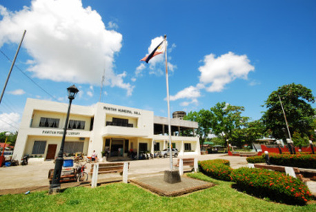
Monday, February 8, 2016

kasadyahan sa capiz (pilar)

History of Pilar
The coastal town sprang out from an Austronesian settlement in the early 16th century when indio natives managed to escape oppression from Spanish colonial authorities. The settlement was then known as Sibala, named after the river that ran through the coastal village. In 1570, however, the settlement was seized by Spanish forces and the guardia civil took full control of the village fortifying it with a military garrison. It later flourished into a bigger town and was renamed after its designated patron La Nuestra Señora del Pilar (Our Lady of the Pillar). In the 18th century, it adopted the (Holy Trinity) La Santisima Trinidad as its municipal patron after a wooden image of the Holy Trinity from the wreckage of a Spanish galleon ship en route from Mexico was found in the town's coastline. Augustinian friars were initially assigned to preach in the town since then until it would later receive its permanent parish priest and Roman Catholic Church.
In 1887, there had been an armed insurgency known as the Battle of Balisong during the Philippine Revolution in an attempt to overthrow Spanish authorities in the municipality led by local revolutionaries with the support of other resistance groups in Capiz, namely from the neighboring towns of Pan-ay and Pontevedra.
In 1949, the sitios and barrios of Aranguel, Culilang, Pandan, Pinamihagan, Cadoulan, Quiajo, Sangcal, Pondol, Marita, Madulano, Jabuyana, Bo-ac, Cabugcabug, Goce Badiangon, Bayuyan, Agbobolo, Cubay, Ibaca, and the sitio of Lotudlotud, which was converted into a barrio of Elizalde, were separated from the municipal jurisdiction of Pilar to form a separate town, namely President Roxas, by virtue of Republic Act No. 374.

Tourist Attraction

Agtalin Shrine
The 85-feet tall statue of Miraculous Medal is considered as the highest Marian statue in Asia. Thousands of devotees flocks every 1st Saturday of the month to Agtalin Hill located at Brgy Dulangan, Pilar, Capiz. You can appreciate the fresh air on top. There are 185 steps of stairs before you could reach the top.
Thousands of devotees flocks every 1st Saturday of the month to Agtalin Hill. It is a religious and solemn place which is suitable for praying and hearing mass.

Lola Ibe
“Lola Ibe” is the remains of Maria de Juan Basañes.  It has been existing for 8 decades. After 10 years of her death, her grave was dug up to be replaced by her dead “apo”, it was then discovered that her body had not yet fully decayed. She is said to be a saint by the locals.

Stunning Cave and Hill formation

 Balisong Hill
The Balisong Hill is one of the tourist attractionof Pilar because of ots historical contribution. It is where the famous Battle of Balisong in 1887 happened, between the Casadores-Spanish soldiers and the Pilareño took place. It is located in Brgy. Natividad.
It has a  natural beauty because of the forest and white color of rocks. The place is great for hiking, trekking and rock climbing.

Balisong cave
Balisong cave is the graveyard of Balisong Heroes. It is also known as the Butete Cave. The cave has also an archaeological and environmental significance and value. It is untouched with beautiful rock formations. According to a cave expert, its karsts formation and wild-life are unique and its limestones is one of the oldest in Panay Island. The cave is perfect for activities like spelunking.

Puting Bato Cave
Puting Bato Cave is abundant if granite and marbles. Its environmental value is preserved because it is privately owned. Mythically, people believed that the cave is inhabited by spirits that could cause illness and bad luck once it is bothered and destroyed. Inside the cave is an altar formation of rocks and stalacite.

Falls
Hinulugan Falls
The Hinulugan Falls is located in Brgy. Tabunacan. It is one of the most breath-taking tourist attraction in the municipality of Pilar. Enjoy the refreshing and cold water that would revive and invigorate your spirit.. It is surrounded with the natural beauty of nature. For adventurers, hiking could be done going to its final top that takes 20-30 mins.

Lalawgon Falls 
Lalawgon Falls is unique because of its S-shaped structure. It is located in Brgy. Yating. It takes 1 kilometer to reach the place perfect for those people who enjoy trekking and adventure. The water from the falls is clean. The area is surrounded witha virgin forest with a beautiful scenery and learn to appreciate nature.

Kawawa Falls
Kawawa Falls is located at Barangay San Silvestre, Pilar, capiz. It is called “Kawakawa”because of its natural formation is shape like a big frying fan. It has falls above it with clear waters flowing down the kawa with 15 feet deep. it has a diameter of round 10 meters and surrounded by “dalipe” or solid rocks. it has a distance of 1.5 kilometers from the Barangay proper and is located near the boundary of San Silvestre & Tabun-acan.


Beach and Reef


Pilar Bay


Pilar Bay covers 10 barangays of the municipality fom Brgy. Dulungan to Brgy. Casanayan and is considered the longest bay in the entire Province. The beach is clean and not over- crowded. It is the main source of fishing industry in the area and nearby municipalities. It is a perfect spot to witness the sunrise and sunset. Pilar municipality waters are also a sanctuary of different marine life.


Tukad Reef

Tukad Reef is a coral reef formation located in the northern part of the municipality. It is a submarine islet of shelled mollusk and corals with layers of sand on top. It is 10 kilometers away from the shoreline of Pilar Bay with an area of 4 hectares. It is seen during low-tide and could only be reached by a boat or raft. 

kasadyahan sa capiz (panitan)

The Panit-ananons inherent their genetic appearance from their Malay ancestors particularly from the brothers DALHOG and DANAO who were supposed to be the founders of the Municipality of Panitan in the year 1621.
Danao got married to Masiid and Dalhog to married Capanang. These family names are still present in the Municipality of Panitan, however not carried by their offspring but have turn into names of three sitios and a lagoon close to the Poblacion center.
The original settlement of Panitan is located at Sitio Capul-an, near the Danao Lake. It was merely behind the coming of the Spanish colonizers that the municipality center was then transferred to where it is currently located.
Traditions notify how the town got its name. The majority acknowledged traditions that tell of a crowd of Spaniards passed by a group of locals peeling the barks off the tree apparently to be dried up for firewood. The Spaniards asked, “Como se llama este lugar? Believing that they were asked what they were doing, they answered back with no hesitations, P A N I T A N, that means to peel off. From then on, PANITAN became the official name of the community as listed by the Spanish overlords.
But for historians like Fr. Juan Fernandez, O.S.A. in his “Monografias De Los Pueblos De La Isla De Pan-ay”, the word “Panitan” comes from a local fish called “Apnit” (Annona rufa), which is plenty in the town like in the usual discussion: “Pacain ca? Paapnitan ako” (are you going to serve a meal? I want Apnit). By the passing of word Paapnitan had become by word and at all period it has been said by the group so that when the Spaniards came they adopted it and make it Panitan due to the intricacy on their part to say the word Paapnitan.
Today Panitan is one of municipality serving its constituents to the fullest. With our Vision , “ A self- reliant, progressive community capable of giving opportunities to its people in unleashing their full potential towards empowerment, dedicated to the preservation of its culture and the promotion of a balanced ecology through complimentary people government partnership” , we believe that we are trekking the right path towards total improvement of the Municipality of Panitan.


The St. Lawrence the Deacon church is the symbol of Panitan as being one of the religious  town in the Province of Capiz.
Most People in Panitan were Catholic and they respect each others beliefs.
Every Holy Week  you can see different people from other places come to witness the yearly holy week celebrated in the Panitan because the people who hear masses really feel the Presence of God and even they different but they are united in praising God as their saviour.

The Dadivas Civic Center is located at Pob. Ilawod, Panitan, Capiz.
It is donated by the former congressman of the province of Capiz Hon. Roging Dadivas.
It is the venue of some special events in Panitan like programs, parties, reunions, basketball games and many other because it can occupy a large amount of people within the civic center.

The Public Tourism Park were formerly known as Dingoy Roxas Park in tribute to the late Congressman Dingoy Roxas.
The Tourism Park is the perfect place for everbody. You can rest, play with your childrens, hangout with your friends, eat with your family and date with your special someone.
It was designed to suit everybody needs in terms of comfortability and peacefulness.
It is located at the center of Panitan in between the Public Plaza and Panitan Bridge.

The Panitan Public Plaza is within the heart of Panitan.
It is where the church, fountain, bandstand and municipal hall is located.
People enjoy playing because of some paying equipments that are present in the plaza like swing, see saw and slide.
Some people also practice in the plaza because of the wide area and the comfortability of the players.
The Panitan Public Plaza is open to all visitors who want to visit and promise them to enjoy the ambiance of the plaza.


by: Kasadyahan sa Capiz


Monday, February 1, 2016

kasadyahan sa capiz (Panay)

Panay or Pan-ay is a third class municipality in the province of Capiz, Philippines. According to the 2010 census, it has a population of 43,449 people. It used to be the Capital of Capiz Province. 
Pan-ay is the site of the famous coral-stone Sta. Monica Church, home to the largest Catholic Church bell in Asia. The bell was made from 70 sacks of gold and silver coins donated by the townsfolk. Measuring seven feet in diameter, five feet in height and weighing 10,400 kilograms or just over 10 metric tons, the Pan-ay bell is popular among tourists visiting Capiz.
An inscription on the bell reads:
“Soy la voz de Diosquellevare y ensalzaredesde el principio hasta el fin de este Pueblo de Panay para que los fieles de Jesus vengan a esta casa de Dios a recibirlas gracias celestials.”Translated to English, this means:
“I am God’s voice which I shall echo and praise from one end to the other of the town of Panay, so that the faithful followers of Christ may come to this house of God to receive the heavenly graces.”

History


The town originally called Bamban was changed by the early Spaniards to Panay, a word which means “mouth of the river.” This is also the location of a fortress built by Juan de la Isla in late 1570. The Paseo de Evangelizacion 1566 can be found in the town plaza and was erected through the efforts of Rev. Msgr. Benjamin F. Advincula. 1566 was the year the Spaniards arrived in the island of Panay and became the second Spanish settlement in the country next to Cebu.

Miguel Lopez de Legazpi transferred the Spanish settlement from Cebu to Panay in 1569 due to the lack of food. The town was formally founded in 1572 (1581 according to Jorde), although by that time Legazpi had moved the capital of the Philippines, further north, to Manila. Fr. Bartolome de Alcantara was named the prior of the town with Fr. Agustin Camacho as assistant. A prosperous town due to trade, Pan-ay became capital of captivating Capiz for two centuries, until Capiz was named capital. The town name was eventually given to whole island. After 1607, Fr. Alonso de Méntrida, noted for his linguistic studies and Visayan dictionary became prior. In the 18th century, Pan-ay was famous for its textile industry which produced a cloth called suerte and exported to Europe. In the 19th century, Don Antonio Roxas, grandfather of Pres. Manuel Roxas, opened one of the largest rum and wine distilleries in the town. The Augustinians held the parish until 1898, when administration transferred to the seculars.

The first church was built before 1698 when it is reported that a typhoon had ruined it. In 1774, Fr. Miguel Murguía rebuilt the church, but it was later damaged by a typhoon on 15 January 1875. Fr. Jose Beloso restored the church in 1884. The church is best known for its 10.4 ton bell popularly called dakong lingganay (big bell). The bell was cast by Don Juan Reina who settled in Iloilo in 1868. Reina who was town dentist was also noted as a metal caster and smith. The bell was cast at Pan-ay from 70 sacks of coins donated by the townspeople. The bell was completed in 1878. It bears an inspiring inscription which translated reads: “I am God’s voice which shall echo praise from one end of the town of Pan-ay to the other, so that Christ’s faithful followers may enter this house of God to receive heavenly graces.”
the structure was first built during the 1690s but was completely destroyed by a fierce typhoon in January 1768. The current church was re-built in 1774 through the efforts of Fr Miguel Murgia only to be severely damaged during typhoons in 1874 and 1875. the church was built by Fr. Miguel Murguia in 1774 and it was heavily damaged by a typhoon on January 17, 1875. Under the supervision of Fr. Jose Beloso, the current church was built rebuilt in 1884. By virtue of the National Historical Institute Resolution No. 3, the church was declared as a national historical landmark in 1997. The church is built in the Filipino Colonial Baroque style with Neo-Classical influence, is a grand structure of coral stone that is 70 meters long, 25 meters wide and 18 meters high. The walls are 3 meters (or about 10 feet) thick and the floor is covered with marble.. The pediment cascades gracefully down. The façade is ornamented with swags of flowers, niches and statuary. The bell tower to the left of the façade is simple in contrast to the façade. It base is planned as a quadrilateral but its upper stories are octagonal with the two sides longer than the other. To the church was attached an L-shaped convento, which had been ruined. Remnants of the covento have been incorporated into the present modern convento. Behind the church are remnants of a wall, which according to town lore was once a fortification. Attached to the sacristy is a large storage room, now converted into a Blessed Sacrament chapel.The interior was formerly divided into a central nave with flanking aisles, but in recent years, the wooden posts that marked the divisions were removed to improve sight lines to the altar. The wooden choir loft was also removed because it was damaged by termites, so were the wooden floors of the bell tower. In place the tower has an independent steel stairway that leads to the topmost floor. This floor has been reconstructed in reinforced concrete with coral stone facing. The roof of the church, already damaged by a storm in 1984 and subsequently repaired, was already in a dilapidated condition in 2000. Its wood work was rotten and was in danger of collapsing. The woodwork and roof have been replaced by a steel and galvanized iron structure. The church retains much of its original floor: terra cotta tiles, white marble and black slate as accents and for the sanctuary. The church has three altars in Baroque style. The retablo of the central altar has been painted over in silver and gold enamel, however, the side altars have hardly been touched and probably represent the original colors of the woodwork—primaries of blue, red, green, orange with gold leaf accents. These altars are unique for Latin inscriptions carved on roundels set in its reed thin columns. Behind Gospel side altar are remnants of decorative painting, also done in brilliant primaries.

 holds the record as the biggest Christian Bell in Asia. It was cast from seventy (70) sacks of gold coins donated by the townspeople. The bell measuring 7 feet in diameter, 5 feet in height and over 10 metric tons was completed in 1878 by Doc Juan Reina, a town dentist and noted blacksmith.

the second oldest street in the Philippines after Calle Colon in Cebu City.

can be found in the town plaza and was erected through the efforts of Rev. Msgr. Benjamin F. Advincula. 1566 was the year the Spaniards arrived in the island of Panay and became the second Spanish settlement in the country next to Cebu.

 is an old Spanish well that was restored and is now one of the major places to visit in Panay. The well is made of coral stones just like the church and was a source of water during the Spanish era. 

    Sunday, January 31, 2016

    kasadyahan sa capiz (Maayon)

    Maayon (sometimes spelled Ma-ayon) is a third class municipality in the province of CapizPhilippines. According to the 2010 census, it has a population of 36,340 people.   Maayon is a stunning town that nature has provided with scenic beauties nature wonders, the serenity and elegance of the surrounding's sustained by the sweet charm and charisma of the people and mired by many. It's  green verdant s hills sparkled by multicolored tops caused by gossamer's white mist of the morning adding the soothing by sound of water from the river minerals deposits , is truly an amazing place to remember.Explore the beauty of Maayon through exciting caves cascading waterfalls. Reminisce the past viewing precious memorabilia, historical Photos,old coins reading materials and other significant items found at the Handurawan Museum and Library. Experience and enjoy the most exciting event that showcases Maayonanon's way of life ,HIL-O HIL-O festival every last Saturday of February.   


    History of Maayon

    Map of Maayon Capiz
    Maayon was created a municipality thru Republic Act 1203 signed into law by the late President Ramon Magsaysay, Sr. on March 30, 1955. It was formerly an“arrabal” of the municipality of Pontevedra until that eventful day when it was created into a new and separate municipality known as the Municipality of Maayon. It is composed of thirty-two (32) barangays with a land area of 18,002 hectares. Its total population based on the census survey in the year 2,000 is 32, 700 with an annual growth rate put at 1.11%. Maayon is situated in the south-eastern portion of Capiz and is 31.6 kilometres far from Roxas City, the seat of the provincial government.
    Signing of Declration of Municipality of Maayon with Pres. Magsaysay
    Some portion of the town is considered flat and hilly and its eastern section is mountainous. Due to the existence of the Maayon River which flows from the boundary of Iloilo in the east towards the Panay River in the west, Maayon has an abundant quarry of gravel and sand.

    It is believed that the mountains of Maayon have rich deposits of valuable minerals like copper, gold rock, manganese, and limestone. Its plains are fertile lands, making the town basically rice producing, and farming as the main livelihood of the inhabitants. Every harvest, Maayon produces a great surplus of palay marketed to the neighboring towns and even to nearby towns of Iloilo.
    To face the challenge and greater demands for development, the incumbent local administration strives to seek its relevance to the dynamic and progressive looking provincial leadership and to keep in stride with the development pace of the rest of Capiz town, forged a VISION – a collective vision which shall be the light of its development goals:
    Municipal Officials of Maayon, Capiz
    ” We envision Maayon as a peaceful, progressively developing community with an agriculture-based economy inhabited by God-loving, healthy and educated Maayonanons adequately served of basic services with sufficient food supply.”
    To come to this vision, we commit to a Sustainable and Environment-Friendly Agriculture Productivity Program, a Comprehensive Social Services Program, a Community-Based Environmental Management Program, a Demand-Driven Infrastructure Development Program, a Vision-Mission-Oriented Local Government Organizational Program, a Development-Oriented Revenue-Generation Enhancement Program and People-Empowering and Participative Local Governance.
    The etymological origin of the word is up to now yet unknown, but its concept as practiced in our way of life over the years has been very visible and already firmly assimilated in the culture of Maayonanons.
    Hil-o Hil-o is reciprocity that demonstrates mutual interdependence among our people. It expressed itself in many forms and in many ways. It could simply be taking turns in helping one another to make a heavy work for one becomes lighter. It can also be rendering services or giving material donation for a relative, a friend or a neighbor who is holding a very important affair in the family.
    Maayon Town Fiesta
    All through the years, theMaayonanons, generation after generation has preserved this peculiar desirable trait in our community. Nurtured by experience and guided by the admonition of our elders to think well of others, Hil-o Hil-o is now deeply assimilated into the culture of the Maayonanons.

    Certainly, it will stay and last forever. We are wont to it already. Furthermore, it is a positive attribute that should be kept forever, that helps Maayonanons become more cohesive.
    Hil-o Hil-o , the Maayonanons way of life.


    Tourist Spots In Maayon, Capiz

    Mag-Olot Falls


    Mag-olot Falls Resort in East Villaflores  Maayon Capiz  is one of the tourist attraction of Maayon. Mag-olot Falls Resort is located on the Southern Portion of the Barangay.


    Green Field 
    Picture
    This is the Green fields of Maayon which is one of the beautiful view that could found in Maayon.

    Igang Cave

    Picture

    This is one of the tourist attractions in the province of Capiz, could be found in Barangay Tapulang, Maayon. It is 7 kilometers away from the town proper. It has many entrances at different levels all leading in main chamber which is well lighted and well ventilated.

    View of Brgy. Old Guia Maayon
    Picture

    This is one of the beautiful place  that anyone can visit and view that could be  found in the Barangay Old Guia Maayon.

     FIESTA OF MAAYON

    Picture

    Maayon Municipal and Religious Fiesta known as Hil- o Hil-o Festival which notes reciprocity that demonstrates interdependence among our people. It expresses itself in many ways. It could simply be helping one another to make a heavy work for one be lighter. It can be rendering of services or giving material donations for a relative, a friend or a neighbour who is holding a very important affair in the family. This Festival is celebrated annually every 3rd week of February  for three (3) days starting Thursday. 


    by: Kasadyahan sa Capiz

    Legislative Districts of Capiz

    The Legislative Districts of Capiz, namely the first and second districts, are the representations of the Province of Capiz in the Philippine House of RepresentativesCapiz was divided into three legislative districts until 1957, when Aklan was granted its own representative, reducing it to two legislative districts. It was part of the representation of Region VI from 1978 to 1984, and from 1984 to 1986 it elected 2 assemblymen at-large. Romblon was last represented as part of the third district of Capiz in 1919.

    1st Districts of Capiz

    1. Maayon
    2. Panay
    3. Panitan
    4. Pilar
    5. Pontevedra
    6. President Roxas

    2nd District of Capiz

    1. Cuartero
    2. Dao
    3. Dumalag
    4. Dumarao
    5. Ivisan
    6. Jamindan
    7. Mambusao
    8. Sapian
    9. Sigma
    10. Tapaz


    Legendary and History Of Capiz

    Capiz is a province in the Philippines located in the Western Visayas region. Its capital is Roxas City and is located at the northeastern portion of Panay Island, bordering Aklan and Antique to the west, and Iloilo to the south. Capiz faces the Sibuyan Sea to the north.
    Capiz is known for the Placuna placenta oyster shell that has the same name locally and is used for decoration and making lampshades, trays, window and doors. Likewise, the province is known as the "Seafood Capital of the Philippines" and was among the top 15 most frequently visited places in the Philippines. Capiz is the site of the famous coral-stone Santa Monica Church in the town of Pan-ay, home to the largest Catholic Church bell in Asia. The bell was made from 70 sacks of gold and silver coins donated by the townsfolk. Measuring seven feet in diameter, five feet in height and weighing 10,400 kilograms or just over 10 metric tons, the Pan-ay bell is popular among tourists visiting Capiz.
    The account of early Spanish explorers about Capiz and its people was traced back in the year 1566 when the Spaniards set foot in the mouth of Banica river. Early settlements were seen in the town of Pan-ay which the town originally called Bamban which was changed by the early Spaniards to Panay, a word which means "mouth of the river." This is also the location of a fortress built by Juan de la Isla in late 1570. The Paseo de Evangelizacion 1566 can be found in the town plaza and was erected through the efforts of Rev. Msgr. Benjamin F. Advincula.
    When the Spaniards led by Miguel López de Legazpi came to Panay from Cebu in 1569, they found people with tattoos, and so they called the island Isla de los Pintados. How the island itself came to be called Panay is uncertain. The Aeta called itAninipay, after a plant that abounded in the island. Legend has it that López de Legazpi and his men, in search of food, exclaimed upon the island, pan hay en esta isla!. They established their first settlement on the island at the mouth of the Banica River and called it Pan-ay. This was the second Spanish settlement in the Philippines, following San Miguel, Cebu. Unknown to many, Calle Revolución in Panay town is the second oldest street in the Philippines after Calle Colon in Cebu City.
    Later in 1569, Captain Diego de Artieda, who was sent by Legazpi, landed in the Town of Panay and proclaimed it as the capital of the province. Later, the Spaniards moved the capital to its present site upon discovering the town of Capiz (not the province, and now Roxas City) which was near the sea and provided docking facilities.
    The province was created a separate "encomienda" and was later organized into a politico-military unit in 1716. The American takeover of the Philippines resulted in the establishment of a civil government in Capiz on April 15, 1901 by virtue of Act 115.
    In 1942, the region was occupied by Japanese troops. In 1945, the region was liberated by the joint Filipino and American troops with Capiznon guerrillas.
    Capiz and Aklan were united under one province until April 25, 1956, when President Ramon Magsaysay signed into law Republic Act 1414 separating the two entities. 


    by: Kasadyahan sa Capiz

    %MINIFYHTML4b44b250e777a23ea2b26322c3731b798%% MINIFYHTML4b44b250e777a23ea2b26322c3731b799%